

WHITE BEAR LAKE CONSERVATION DISTRICT
LAKE MANAGEMENT PLAN
MAY 1999
SITUATION ANALYSIS
Plan Development Committee Structure
Steering Committee
Two members of the WBLCD Board who a) provided general oversight, b) coordinated the planning process and c) served as liaisons between the WBLCD and the community at-large.
Steering Committee: David Scheer and Mary Sue Simmons
Advisory Committee - Representatives of the community empaneled to develop the substantive aspects of the management plan and assure it effective implementation.
Advisory Committee: Lynn Ault, Sheila Cunningham, Roger Carlson, Keith Dehnert, Fletcher Driscoll, Dave Guenther, Mary Hauser, George Hill, Matthew Hoffman, Brian Lind, Dale Johnson, Marian Johnson, Skip Johnson, Jock Ramaley, Kim Rich, Brian Seim/Bob Broen, Dean Shawbold, John Steinworth, John Velin, Oliver Washburn, Ron Wenzel, Sue Wolsfeld
Technical Committee - Called upon to provide technical input that may be needed to clarify technical matters.
Technical Committee: Randy Anhorn (Metropolitan Council), Kate Drewry (Rice Creek Watershed District), Mark Doneux (Washington Soil & Water Conservation District), Dave Ford (MN DNR), Mike Halvorson (MN DNR), Scott Kelling (MN DNR), Matt Moore (MN Board of Water & Soil Resources), Terry Noonan (Ramsey County), Tom Peterson (Ramsey Soil & Water Conservation District), Molly Shodeen (MN DNR), Mark Tomasek (MN PCA), Chip Welling (MN DNR), Bruce Wilson (MN PCA), Dave Zappetillo (MN DNR)
Consultant & Facilitator
Dick Osgood, Ecosystem Strategies
The condition of White Bear Lake, community interests and concerns about the lake, and an overview of management problems was summarized in the Report on the Condition of White Bear Lake which is appended to this report (Appendix I). This section summarizes the findings contained in that report and represents the point of departure for the work of the Advisory Committee.
PHYSICAL ENVIRONMENT
By nearly all measures, White Bear Lake’s quality is among the best in the metropolitan area. The levels of pollution are low, the problems with algae are minimal, the fish and aquatic plants in the lake are healthy, and threats to all of these appear to be minimal or at least manageable. But, there are concerns. Over the past ten years lake levels have fluctuated up to 5 feet. There are species of exotic plants inhabiting the lake, pollution in runoff from future urban expansion will likely increase, and overall use and user conflicts appear to be increasing.
COMMUNITY SURVEY
White Bear Lake is a highly valued resource that provides aesthetic, recreational, commercial and wildlife benefits to the community and all lake users. Indeed, the lake is the focal point of the community. The lake is heavily used for both passive and active recreational activities. The increasing urban population as well as the changing nature of recreational use has caused increasing concerns with regard to noise, crowding and access to the lake.
Other management concerns include, but are not limited to, the spread of Eurasian watermilfoil, the increase of pollution to the lake, whether or how to manage fluctuating lake levels, and the effective management of the lake by the White Bear Lake Conservation District.
PROBLEMS & CONCERNS
Five specific problem areas were identified for further deliberation, evaluation and action. These formed the framework for the development of management goals, management strategies and actions. The problem areas are generally categorized as concerning:
- Lake uses
- Milfoil and other exotic species
- Runoff pollution
- Lake level
- Leadership and direction from the White Bear Lake Conservation District
VISION
The Advisory Committee has adopted this vision statement meant to guide the long-term management of White Bear Lake:
White Bear Lake is the focal point of our community. The lake is highly valued for its aesthetic, recreational, commercial, environmental, aquatic life, and fish & wildlife qualities. These qualities and values should be protected and preserved for present and future generations.
GOALS
To support this vision as well as to address the identified problems and concerns, the Advisory Committee has adopted nine goals:
Goal #1 The White Bear Lake Conservation District should be an advocate for the enlightened management of White Bear Lake.
Goal #2 Lake use should not exceed thresholds for crowding, noise, safety and environmental damage.
Goal #3 Use and development of the lakeshore should complement the overall use of White Bear Lake.
Goal #4 Provide information, education & enforcement that is critical for managing lake use.
Goal #5 Protect the healthy native aquatic plant community in White Bear Lake.
Goal #6 Prevent Eurasian watermilfoil or other exotic species or natural species from becoming a recreational or ecological nuisance.
Goal #7 Pursue all opportunities, present and future, to reduce phosphorus inputs to White Bear Lake.
Goal #8 Identify other kinds of pollution to White Bear Lake and reduce their input.
Goal #9 A plan to protect the levels of aquifers critical to White Bear Lake level is needed.
In this section, each of the identified problem areas are further evaluated as guided by the goals adopted by the Advisory Committee. In addition, other planning elements are introduced and evaluated here.
[Goal nos. 2, 3 & 4]
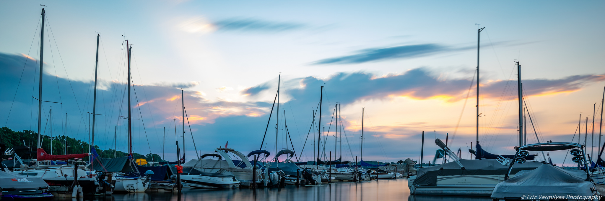
The nature of lake use appears to be changing and intensity of lake use is perceived to be increasing on White Bear Lake. Larger, faster and noisier watercraft are disrupting the quietude on and near the lake, causing congestion, and may be posing environmental and safety concerns. Regulations meant to moderate these activities may either be inadequate or not well enforced. Public, private and commercial access points around the lake are of concern too because of the increased activity and potential conflicts with adjacent lands as well as being control points for lake activities. If one type of access requires control, it automatically raises the attention of all others out of consideration for fairness and balance.
Winter uses also pose some concerns, such as excessive vehicle speed, pollution, noise and safety.
A recent study (MN DNR 1997) has indicated that White Bear Lake and other similar lakes in the metro area may be crowded, but it is unclear whether this is an immediate concern in White Bear Lake. As well, the pending sale of the Johnson Boat Works property and continued expansion of docking facilities has raised the awareness of the total use and activities in the Commercial Bay area. A comprehensive evaluation of the use of the lake and adjacent lakeshore is timely.
There are multiple access points to White Bear Lake. There is no objective information on the proportion of total lake use that is generated by the various categories of access. As well, there is only a vague standard to guide whether the lake is crowded. By investigating the guidelines of other agencies around the country, it appears that lakes are ‘crowded’ when the number of watercraft exceeds one for 10 to 20 per acres of lake surface. The maximum boat density on White Bear Lake appears to be about one boat per 15 acres during holiday and weekend afternoons. The boating density does not account for the differential impacts in various areas of the lake. For example, a lower density of watercraft may have a greater impact in shallow or nearshore areas.
According to the stakeholders (Appendix I), the present boat density is at the threshold for crowding during peak use periods. Thus, even though we lack a precise baseline, such as an estimate of boat numbers, their access points, or how and where they influence lake over-crowding, the Advisory Committee feels that boat densities should not be increased over current levels.
As the issue of public access is evaluated, it is important to clarify the terms being used. All access points are ‘public’ to the extent that anyone can use them. Some may require payment of fees or membership in a club. Concerns with public access normally center around the provision of public access by a public agency. In this case, the Minnesota Department of Natural Resources coordinates a program of providing public access to state lakes in cooperation with local agencies. The capacity of a lake is taken into account as the MN DNR plans for providing public access. The criterion used is one car-trailer parking space for every 20 acres of lake surface. To be counted, the car-trailer parking space must:
- Be open at least 16 hours per day between 4 a.m. and 12 midnight.
- Have no fees charged for launching any watercraft.
- Have no special regulations that do not apply equally to riparian boaters.
In addition to these state criteria for providing public access, there are other access points around White Bear Lake that are through public lands or public facilities - for example, Mahtoska Park which charges a small fee for boat mooring and launching or Bellaire Beach where carry-on watercraft are launched into the lake.
The categories of access around White Bear Lake are listed below:
Public Access. There are now 37 car/trailer parking spaces at Ramsey County Beach. The MN DNR speaks for the public needs with regard to adequate access and their goal for White Bear Lake is 121 car/trailer parking spaces. It is recognized that substantial access occurs through the practice of parking along public roads near the Ramsey County Beach and that during peak times that actual use of the public access may approach the DNR’s goal. Street parking is regulated locally and could be restricted at any time. The boat ramp at the beach is not designed to accommodate the additional traffic. At peak use times, actual use of the boat ramp may approach the DNR’s goal, but this is not an ideal situation. It is desirable to expand the number of public access spaces around White Bear Lake and eliminate the burden of parking along adjacent public roads. Additional car/trailer spaces should be provided by adding additional sites around the lake rather than over-taxing Ramsey County Beach and local street congestion.
Riparian Use. The maximum number of watercraft per riparian (lakeshore) and easement owners is limited to no more than four docked watercraft without a permit from the WBLCD. The actual number of watercraft used by riparian owners is unknown.
A MN DNR survey of residential moored watercraft conducted on 25 July 1994 showed:
| Watercraft Type | Numbers |
| Fishing/utility | 486 (35%) |
| Runabout | 338 (24%) |
| Sailboat | 222 (16%) |
| Pontoon | 206 (15%) |
| Canoe | 89 (6%) |
| Paddle boat | 30 (2%) |
| Personal watercraft | 13 (1%) |
| Wind surfboard | 13 (1%) |
| Inflatable raft | 7 -- |
| TOTAL | 1,404 |
Multiple Docks and Associations. Docks having five or more watercraft (multiple docks) and dock associations require a permit from the White Bear Lake Conservation District.
| Associations | |
| Ash 8 units | 8 units |
| Alicia | 5 units |
| Birch | 8 units |
| Dellwood | 12 units |
| Elm | 8 units |
| Kay | 0 units (swimming only) |
| Portland | 5 units |
| Private Docks | |
| Hospital Health Plan | 4 units |
| McCartney Estates | 6 units |
| Wildwood Condos | 11 units |
Marinas and Ramps. Marinas are concentrated in the Commercial Bay, plus Mahtoska Park and the White Bear Yacht Club. There are also public and private ramps and launch sites where watercraft can be launched. None of these facilities are considered ‘public access’ according to the MN DNR’s guidelines. The number of watercraft units are as follows:
| VFW | 20 slips (22 rented) |
| Johnson Boat Works | 160 slips (160 rented) |
| Tally Dockside | 0 slips ( 42 approved) |
| 25 rental boats | |
| White Bear Docking | 200 slips (186 rented) |
| White Bear Yacht Club | 38 lifts (38 rented) |
| 10 off lake ( 10 rented) | |
| 2 slides ( 2 rented) | |
| Mahtoska Park | 75 slides (58 rented) |
| 12 off lake (18 rented) | |
| 40 moorings (29 rented) |
Launch Sites
| Bellaire Beach | Car-top (no fee) |
| Mahtoska Park | Ramp (fee) |
| White Bear Docking | Ramp (fee) |
| White Bear Yacht Club | Ramp (fee) |
At any given time, all watercraft on White Bear Lake originate from one of these sources. However, we do not know whether any particular source contributes disproportionately to crowding, noise or other undesirable conditions. Further, because the impacts of various watercraft differ - a canoe tends to be less obtrusive than a personal watercraft - we need more objective and contemporary information regarding the overall use patterns and their impacts. Therefore, the Advisory Committee recommends that:
The WBLCD commission a study of total lake use, including the Commercial Bay (for example, how many boats, boat size and use of the lake). Further, the study should include the impact of boats on the quality of the lake. A public survey should be included asking people what they think is the right mix of boats for lake use.
Any WBLCD recommendation regarding the future management or control of lake access should strongly consider the results of this lake use study.
As with summer use, there are corresponding concerns with winter use of White Bear Lake. However, because winter uses are not planned and facilitated in the same way as summer uses, we have less objective information on the kinds and intensities of winter uses.
There a concerns regarding crowding, noise, speed, safety, enforcement and environmental damage caused by winter use on White Bear Lake. The only objective information available at the this time is an inventory of ice fishing houses. The number of ice houses have been routinely counted by the MN DNR and have steadily declined from 1985 (389 houses) to 1994 (157 houses).
Lake Use Ordinances and Enforcement
The stakeholder survey as well as the Advisory Committee identified concerns with watercraft speed, hours of operation, proximity to the lakeshore, and safety during both the winter and summer. The WBLCD has numerous ordinances that address most of these concerns to some degree (Appendix III); however some are vague (noise in the summer) and some are not well enforced (speed, proximity to lakeshore). Therefore, Advisory Committee feels there is a need for more enforcement as well as a precise noise ordinance (see below).
In light of the concerns raised above, enforcement appears to be lax. The enforcement record for White Bear Lake in 1998 includes the following number of warnings and citations issued by the Sheriff:
| Violation | Warning / Citation |
| Unsafe Operation | 23 / 1 |
| Speed | 12 / 2 |
| Exhaust/Sound Level | 0 / 0 |
| No Wake | 47 / 5 |
The stakeholders survey as well as the Advisory Committee identified watercraft noise as an issue that requires attention in this management plan. There are two main issues with respect to noise: 1) excessive noise that interferes with the use and enjoyment of the lake and 2) noise during normal quiet times, like early morning. The Advisory Committee agreed that the ordinances dealing with hours of operation are adequate at this time.
There are several methods to mitigate excessive or obnoxious noise. These include restricting hours of operation, limiting the maximum noise level emitted by a watercraft, or keeping noisy watercraft at a distance. All of these are addressed to some extent in existing ordinances. For example:
- Hours of Operation. Existing ordinances restrict hours of operation for personal watercraft - not allowed between 8 p.m. and 8 a.m. Other watercraft are not restricted.
- Excessive noise. The existing ordinance is vague, not allowing ‘excessive’ or ‘unreasonable’ noise.
- Distance. All watercraft must observe minimum wake or speed limit rules near shore and near other structures, watercraft or public beaches. Generally watercraft must be ‘quiet’ within 100 feet from the shore.
The problem is there are gaps in the rules, the ordinances are vague, or there is inadequate enforcement.
What is a comfortable sound level?
Sound intensity is measured by decibels (abbreviated dB). An EPA study (EPA 1974) examined health considerations of noise and found there are two applicable thresholds:
- 55 dB is a threshold for ‘interference of activities’
- 70 dB is a threshold for ‘hearing loss considerations’
The 55 dB threshold is reasonable for ‘quiet-type’ activities such as in a residential or a park setting. In that setting, a background noise level exceeding 55 dB would begin to interfere with normal conversation.
The 70 dB threshold would, if sustained, begin to be a concern for hearing loss and maybe other health effects. This threshold appears to be an appropriate target for recreational activities on White Bear Lake.
The noise generated by a ‘noisy’ watercraft may be up to 105 dB for the operator. Considering that sound levels diminish by approximately 6 dB in the first 50 feet, then 6 additional dB for every doubling of distance thereafter, sound levels would be:
| 105 dB at | 0 feet (the watercraft operator) |
| 99 dB | at 50 feet |
| 93 dB | at 100 feet |
| 87 dB | at 200 feet |
| 81 dB | at 400 feet |
| 75 dB | at 800 feet |
Given the existing distance ordinances - 100 feet from shore or other watercraft - the 70 dB target is likely to be exceeded.
Noise ordinances limiting the maximum sound generated by a watercraft have been implemented in other states and on individual lakes. The Lake Minnetonka Conservation District for example, has implemented a noise ordinance that requires that no watercraft can exceed 80 dB at a distance of 50 feet. According to the Hennepin County Water Patrol, this ordinance is enforceable and has resulted in a decrease in offending watercraft on Lake Minnetonka. Such a restriction on watercraft noise would meet the 70 dB target at a distance of 100 to 200 feet:
| 80 dB | at 50 feet |
| 74 dB | at 100 feet |
| 68 dB | at 200 feet |
To better meet the target, it may be helpful to increase the minimum wake zone on White Bear Lake from 100 feet to 200 feet.
Because sound travels differently in winter conditions on lakes as well as a lack of research on the noise issue, it is not possible to adequately evaluate the noise concern at this time; although the WBLCD has a decibel limit for winter activities (Appendix III).
The Advisory Committee has discussed the issues of activities in the Commercial Bay as well as compatible adjacent land uses. Due to lack of objective information as well as guidance on concerns of traffic, congestion and pollution, we are not able to make specific management recommendations at this time. To have a rational basis to make those recommendations, the Advisory Committee has recommended a lake use study (see pages 11 and 12) that would include gathering the information necessary to plan for and manage activities in and around the Commercial Bay.
Following that study, the Advisory Committee recommends that the City of White Bear Lake and the White Bear Lake Conservation District develop a comprehensive plan for the ultimate development and use of the land and water of the Commercial Bay.
MILFOIL AND OTHER EXOTIC SPECIES
[Goal nos. 5 & 6]
Eurasian watermilfoil has taken the spotlight in recent years. It is important to point out that milfoil is established in an existing diverse native plant community in White Bear Lake. So while the management and control of Eurasian watermilfoil receive prominent attention, the protection of native plants also deserves our attention. Indeed most aquatic plants need protection, not elimination.
Eurasian watermilfoil has been in White Bear Lake for over 10 years. While milfoil has not caused widespread and severe problems as yet, there is great concern that, like many other lakes, it could become problematic. White Bear Lake also has a healthy, diverse native aquatic plant community. The native plants provide benefits to the lake's fish habitat and water quality. To some extent, these plants may have even retarded the growth and spread of milfoil.
Even though Eurasian watermilfoil has been in the lake for over ten years, it has not grown to the surface or caused recreational nuisances, except in small areas. However in 1998, the nuisance with milfoil worsened, especially later in the summer. A number of factors may normally limit the growth of milfoil in White Bear Lake: a) low fertility of the sediments and water, b) competition from a healthy native plant community, and c) the lack of widespread nuisance aquatic plant control methods.
A comprehensive survey conducted in 1998 found that milfoil was present in 56% of the sampling locations around the lake, but represented a nuisance - that is, grew to the water surface - in only five locations representing a total of nine acres (McComas and Stuckert 1998). This coverage represents less than 1% of the lake surface. However, as noted above, the milfoil problem became especially noticeable in several areas of the lake during September, after the survey was conducted. A diver survey commissioned by the White Bear Lake Homeowners Association had results consistent with the WBLCD survey (Buddy Diving Services 1998).
In a related study commissioned by the White Bear Lake Conservation District (McComas and Stuckert 1998), it was determined that the fertility of the lake's sediment could be used to indicate where milfoil could potentially grow to nuisance levels. This study found that milfoil had the potential to grow to nuisance levels in only those few areas in White Bear Lake where sediment nitrogen was high. Even with this information, the Advisory Committee was concerned that we do not fully understand the milfoil nuisance potential in future years. As a result, the Technical Committee advised that the levels of milfoil observed in 1998 will likely be exceeded in the future (see Appendix IV). The Technical Committee could not specify how much more milfoil might be expected compared to the observed levels in 1998 or in what years the nuisance might be better or worse.
Dealing with Milfoil Management Issues
There have been problems with how the issue of milfoil management in White Bear Lake has been discussed. Unfortunately much of the past debate appears to have been based on fears rather than objective information. The opposing fears can be described generally as the fear of milfoil taking over the lake versus the fear of inappropriate use of chemicals to control milfoil. During the development of this plan, it appears that many of these concerns have been reconciled by either agreeing to disagree or by providing authoritative and neutral technical guidance. The discussion below answers some of the questions that have been of concern and describes areas of consensus that will allow for the most effective and appropriate future management of milfoil and aquatic plants in White Bear Lake.
Are there trends?
Eurasian watermilfoil represented an increased nuisance in 1998 compared to the past several years. It is not possible to compare the condition observed in 1998 to earlier years because there are inadequate objective or comprehensive data available from those years (except 1997). Despite the increased abundance in 1998, there is no evidence that there is a trend. Indeed, while there may be years where milfoil could be worse than in 1998, there is no way to predict in advance which year or years that will occur (Appendix IV). It was also concluded that the kinds and intensity of control activities do not influence the distribution or potential nuisance level of milfoil in subsequent years.
This means that milfoil control strategies for a given season should be determined on the basis of conditions known to exist or reasonably expected to develop only the during that season.
What is a ‘Nuisance’?
To determine when control measures are needed, the Advisory Committee spent a good deal of time discussing what about milfoil and other aquatic plants represented a nuisance. The Advisory Committee agreed on these characterizations:
- When milfoil or aquatic plants interfere with recreation.
- When milfoil or aquatic plants prevents reasonable access to the lake.
- When milfoil or aquatic plants interfere with safe and effective navigation.
- When milfoil displaces native plants.
- When milfoil forms surface mats that collect debris and are a visual blight.
In addition, there are specific areas in White Bear Lake where aquatic plant nuisances present unique concerns:
- The Commercial Bay (navigation)
- The Matoska Marsh, Hall’s Marsh and other similar areas (protect native plants)
- The nearshore area (riparian access)
- Public use areas (swimming & navigation)
The Advisory Committee is aware that some of these reasons are inconsistent with MN DNR guidelines for issuing nuisance control permits. Specifically, aesthetic nuisances are not sufficient justification for control. Also, floating-leaved plants, like water lilies, cannot be removed.
What is the most effective management strategy?
Evaluating management strategies in the context of what constitutes a nuisance will provide a framework for management action. There are four general control approaches available for managing aquatic plant nuisances. Any one or any combination can be considered:
- Leave alone
- Mechanical control - harvesting, hand pulling, bottom covering
- Chemical control - various herbicides
- Biological control
There have been concerns regarding the use of chemical herbicides in White Bear Lake. These concerns are discussed here so they can be weighed against other possible management options.
Beginning in 1989, the herbicide 2,4-D has been used in certain areas of White Bear Lake to control milfoil. 2,4-D is a systemic herbicide - meaning it gets into the plant - used to control broad-leafed plants. Some people in the community have expressed concerns about whether the use of 2,4-D is the best tool available for long-term control of milfoil, citing concerns regarding the impacts of the chemicals on non-target plants and animals. Other people are aware that 2,4-D and other herbicides have been used in other lakes to control Eurasian watermilfoil and other nuisance aquatic plants. There is a long standing disagreement and conflict surrounding these concerns, that has hindered aquatic plant management and control decisions.
The issue appears to be a matter of different comfort levels with the risks associated with using 2,4-D. On the one hand, some are comfortable that 2,4-D is a product registered by the U.S. Environmental Protection Agency for aquatic use (per label instructions) and is permitted for aquatic use by the MN Department of Natural Resources. If the regulatory and permitting agencies and authorities allow its use, then using 2,4-D is okay. On the other hand, others, given the experience with other chemical agents that have retrospectively been shown to be harmful, believe it is not worth taking any risk, and therefore 2,4-D should not be used at all.
It appears that the issue comes down to a difference in the level of comfort regarding what an acceptable risk is. There is no objective way to resolve this issue at this time. The Advisory Committee has agreed that the best solution at this time is to acknowledge this difference as well as the concerns of both points of view. The Advisory Committee has further agreed that the White Bear Lake Conservation District as a public policy-making body is the authority to decide on control methods for public use areas of White Bear Lake as well as to coordinate the overall control and management efforts for aquatic plants.
New Technologies
The use of bottom barriers as another tool to control nuisance aquatic plants that could be considered in White Bear Lake. Because bottom barriers are not now allowed for use in Minnesota lakes, the WBLCD should negotiate a variance on behalf of all interested parties.
Materials that cover bottom areas have been used with great success to control nuisance aquatic plants around the United States. These materials are either anchored to or sink to the lake bottom and smother plants to prevent their growth. Because of concerns with plastic sheets, the only materials available many years ago, the use of all such materials has been forbidden in Minnesota. New materials are now available which are safe and effective. Negatively buoyant screens are available in rolls 7 feet wide and 100 feet long which can be laid on the lake bottom in the spring and removed in the fall. These screens can be reused for about 10 years.
Bottom barriers would be appropriate for controlling aquatic plant nuisances in small areas such as adjacent to docks or piers. Using barriers has several advantages:
- safe, effective, non-chemical control using a simple technology
- reasonable cost (approximately $300 per bolt, 7' x 100')
- reusable for about 10 years
The WBLCD should keep exploring other technologies for controlling nuisance aquatic vegetation in White Bear Lake.
Who should coordinate and be responsible for milfoil and aquatic plant control?
Individuals and organizations can control milfoil and other nuisance aquatic plants. For the most part, control activities require a permit from the DNR (see Appendix V). Individual lakeshore owners can control or remove aquatic plants from areas adjacent to their property. The DNR will normally grant a permit for control activities out 100 feet into the lake and along 100 feet or 50% of the shoreline, whichever is less. Commercial organizations, such as marinas, may control nuisance plants in areas where navigation is hindered, again with a DNR permit. Finally, the White Bear Lake Conservation District can control nuisance aquatic vegetation in other areas of the lake. The DNR will limit chemical control activities to no more than15% of the littoral area of a lake.
The Advisory Committee feels that the White Bear Lake Conservation District should coordinate and increase its role in controlling milfoil and aquatic plant nuisances in White Bear Lake. The White Bear Lake Conservation District has the statutory authority to "... regulate the mechanical and chemical means of removal of weeds and algae from the lake." By the same token, the MN DNR is the agency responsible for permitting aquatic plant control activities in White Bear Lake. At a minimum, the White Bear Lake Conservation District should annually develop and implement an aquatic plant management plan consistent with goal nos. 5 and 6. This means that the District should develop an annual action strategy at the beginning of each season that includes:
- An annual aquatic plant survey.
- A determination of what general areas of the lake are subject to WBLCD control.
- Developing and distributing information materials to coordinate the overall aquatic plant management in White Bear Lake. These materials should include information on:
- Aquatic plant management goals for the lake
- Available control methods
- Permit requirements
- Evaluation requirements
[Goal Nos. 7 & 8]
There is concern that pollution from runoff to White Bear Lake is excessive. Sources such as stormwater, lawn fertilizers and failing septic systems are suspected. Any source of pollution that is excessive or has an undesirable effect should be controlled.
A water and phosphorus budget - meaning an accounting of inputs and outputs - was completed as part of the Diagnostic-Feasibility Study for White Bear Lake (RCWD 1991). Additional information and analysis is included here to consider a more contemporary assessment of pollution sources. With regard to the lake’s phosphorus inputs, the following numbers best represent an average condition:
| Phosphorus Source | Pounds per year |
| Atmosphere1 | 1,813 (29%) |
| Runoff2 | 930 (15%) |
| Internal sources3 | 3,529 (56%) |
| Water Source | Acre-feet per year |
| Runoff2 | 1,860 (24%) |
| Precipitation2 | 6,040 (76%) |
1. P from atmospheric sources (from literature and local values, 0.7 pounds per acre).
2. From Report on Diagnostic/Feasibility Study of White Bear Lake (1991).
3. Littoral input rate of 2.2 mg/m2/day for 150 days.
The water and phosphorus inputs into White Bear Lake account for the ambient phosphorus levels in the lake water, which is about 20 parts per billion. The Report on the Condition of White Bear Lake (Appendix I) describes the relevance of phosphorus concentration to lake condition. Compared to other metro lakes, White Bear Lake has very low phosphorus concentration and therefore very good water quality.
It is clear from these budget numbers that a small part of the phosphorus and water that enters White Bear Lake is from runoff. This means that a very large reduction in phosphorus from runoff will be necessary to reduce the phosphorus content in the lake. For example, if 50% of the phosphorus from runoff were removed, then the lake’s phosphorus concentration would fall from 20 parts per billion to 19 ppb, a 5% reduction. Despite the small total contribution of phosphorus from runoff, there may be places where improvements can be made.
Dellwood and portions of Mahtomedi are the only remaining communities around White Bear Lake having on-site septic systems. Due to large lot sizes and an effective inspection program, there is no reason to suspect that septic systems are adding phosphorus to White Bear Lake.
As planned urbanization occurs in the eastern portions of the watershed, runoff to White Bear Lake will be increased in two ways: 1) increased impervious surface will result in more runoff from the lands being urbanized, and 2) lands not now contributing runoff to White Bear Lake will likely be added. Stormwater management practices will be required in these areas, but they will not mitigate the full impact of pollution increases.
Recent studies have shown that phosphates in lawn fertilizers contribute to the phosphorus in stormwater. No municipality around White Bear Lake has a phosphorus fertilizer ordinance.
Internal phosphorus sources, that are estimated to comprise the largest single contribution, include the recycling of phosphorus from that previously deposited in the bottom sediments back into the water. This process occurs in practically all lakes. There appears to be no immediate need to mitigate this phosphorus source.
Nitrogen is another plant nutrient which appears to be significant with respect to nuisance Eurasian watermilfoil distribution in White Bear Lake (see McComas and Stuckert 1998). Nitrogen inputs to White Bear Lake have not been measured or estimated.
Some species of fish have elevated levels of mercury (MDH 1998). The proportion of mercury is from runoff is unknown. Often, mercury that contaminates lakes is from atmospheric sources, but it would be useful to know the precise sources in White Bear Lake, so appropriate mitigation can occur.
The specific fish consumption advisory (MDH 1998) for White Bear Lake includes the following:
| Species | Size | Advisory |
| Bluegill sunfish | 5-15 inches | 1 meal/week (women of child-bearing age + children). |
| Unlimited (other persons). | ||
| Northern pike | 15-20 inches | 1 meal/month (women of child-bearing age + children). |
| 1 meal per week (other persons). |
Salt concentrations have steadily increased in White Bear Lake since at least the mid-1970s (Northeast Metro Technical College water testing program). Chlorides, a chemical constituent in salt, have steadily increased in concentration from 13 parts per million (ppm) in 1976 to 24 ppm in 1995. Further, data from Ramsey County indicate the chloride concentration in White Bear Lake was 31 ppm in 1996 and 28 ppm in 1997.
These chloride concentrations are not known to pose environmental or biological hazards. Also, data from other Ramsey County lakes shows White Bear Lake to have one of the lowest chloride concentrations (Terry Noonan, personal communication):
| Lake | Chloride concentration (1997) |
| Bald Eagle | 28 ppm |
| Como | 145 ppm |
| McCarons | 87 ppm |
| Phalen | 100 ppm |
| Snail | 30 ppm |
| Turtle | 25 ppm |
The steadily increasing concentration is still a concern. Therefore, it makes sense to investigate the source(s) of this salt, whether the trend is likely to increase, and at what point it may have undesirable or unwanted impacts.
Phosphorus is only one kind of pollution entering White Bear Lake. Because other kinds of pollution have not been measured to the same extent as phosphorus, we do not know if there is a cause for concern. Typically, other kinds of urban pollution include:
- Hydrocarbons like gas & oils
- Metals like copper, chromium, mercury, zinc, lead
- Pesticides and herbicides from lawn treatments
- Other nutrients like nitrogen
- Synthetic chemicals like PCBs
- Salts such as those applied as road de-icers
- Sediments like sands and silts
- Leaves and organic debris
The Rice Creek Watershed District and the municipalities in the watershed around the lake have implemented plans and programs aimed at reducing pollution from runoff. Their actions demonstrate an openness to take further steps toward improving the lake.
[Goal no. 9]
The lake level in White Bear Lake has fluctuated up to 2½ feet in one year and 7 feet over the lake’s history. Extreme high and low water levels can cause property damage, hinder navigation and impair recreational activities. Pumping from groundwater, which had been done to augment low lake levels, has been discontinued since 1979 and is no longer an option. Low water levels will likely occur in the future, but there is no plan to manage that eventuality.
Because of a change in state policy, the option of augmenting lake levels from groundwater sources no longer exists. Furthermore, the wells that had been used have been or are being sealed to bring them into compliance with the state well code. This is being done in an effort to eliminate them as potential pathways for aquifer contamination sources.
The Minnesota DNR has conducted a detailed study of the White Bear Lake and groundwater system (MN DNR 1998). Principal findings include:
- Lake level fluctuations are strongly correlated with aquifer fluctuations.
- Groundwater augmentation resulted in increased lake levels.
- Groundwater augmentation increased water loss from the lake to the aquifer.
- Groundwater augmentation is not 100% efficient, and may be as low as 14% efficient. In the extreme, this means that for every 100 gallons pumped into the lake, 14 gallons stay in the lake.
- Increases in lake levels from pumping are short-lived, about one year.
A lake level control structure at the lake’s outlet has been modified since the early 1930s or 1940s to maintain higher lake levels.
Lake level augmentation appeared to provide some benefit in terms of short-term lake level increases during low water levels. However, because of a change in state policy that prevents lake level augmentation from groundwater aquifers as well as the lack of any other feasible solutions, the prospect of lake level augmentation should not be further considered at this time.
The recharge area - the area that supplies the aquifer - for the aquifer supporting the level of White Bear Lake extends beyond the surface watershed, especially to the north and east of White Bear Lake. Future urban development of the recharge area could pose a threat to the lake’s water supply if there are significant water withdrawals from the aquifer. Constructing new wells as well as the increase in hard surface which usually accompanies urbanization would reduce recharge of the aquifer thereby exacerbating lake level fluctuations. Because of these concerns, it makes sense to identify the critical recharge areas and work to assure that they are protected as before urbanization occurs.
Finally, it is noted that lake use conflicts are intensified when the lake level is low. While we have learned that we cannot mitigate this situation, we should provide relief during low water levels.
LEADERSHIP AND DIRECTION FROM THE WBLCD
[Goal no. 1]
The Advisory Committee believes that the White Bear Lake Conservation District ought to take the lead role in implementing this management plan. However, they are concerned in light of recent controversies, whether the District would embrace this plan and be in a position to effectively implement the actions called for in this plan.
Resources Needed to Implement this Plan
A simple comparison between the WBLCD and the Lake Minnetonka Conservation District - the only other Conservation District in Minnesota - suggests that the WBLCD may lack the financial resources to effectively administer the programs and actions called for in this plan (see Appendix VI for the specific comparison). The LMCD prepared a lake management plan in 1989 - 1991 and is implementing that plan.
While there are some obvious differences in the scope of the two Conservation Districts, it is reasonable to expect that the WBLCD will need additional resources to effectively administer and implement this management plan in the long run.
The Advisory Committee believes that investments in preserving the quality of White Bear Lake will result in increased value to our community.
Leadership
The Advisory Committee recognizes that the concerns with the District stem from its actions as well as the lack of oversight and guidance from the member cities. The Advisory Committee further recognizes that the White Bear Lake Conservation District is the agency specifically charged with the management of White Bear Lake.
To get past these concerns and on to the task of implementing this plan, the Advisory Committee has adopted a resolution directed to the White Bear Lake Conservation District and its member cities (Appendix VII).